-
出發日期2024/01/07
-
回程日期2024/01/07
-
相關路線
-
相關山岳
精彩預告《石山引水道五連峰》|Alishan Mountains
精彩回顧篇《石山引水道五連峰》|Alishan Mountains
《石山引水道五連峰》嘉義石水山|真鹿林山|鹿林前山|鹿林山|麟趾山|Alishan Mountains【No.11】
心靈鋼琴|忙生活|Busy with Life|Relaxing Piano Music|Piano by PaPa
Yiruma|Spring Waltz |春天的華爾滋|이루마 Piano by PaPa
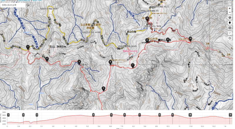
========== 行 程 規 畫 ==========
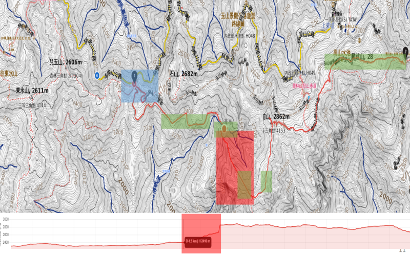
========== 實 際 路 線 ==========
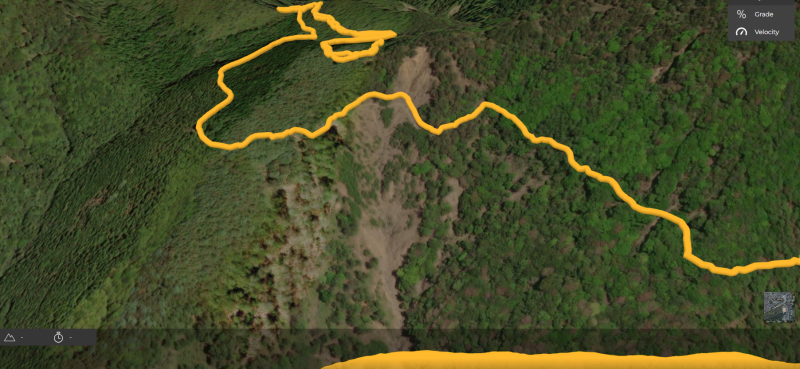
========== 行 程 規 畫 ==========
藍色區塊:偏離導航
綠色區塊:絕美景色
紅色區塊:需有超人及熱忱的登山勇者挑戰
- 一開始我手機的Hiking book軟體守護警報通知及手錶Garmin系統發出逼逼聲音!警告警告您的行經路線已經偏離路線50M,請問要三分鐘後再持續警報或是忽略導航守護,Garmin手錶則一直逼逼逼逼不停,看來善用科技守護真的很有幫助。
| 次序 | 時間 | 休息(分鐘) | 里程(K) | 海拔(M) | 備註日期:20240107 |
|---|---|---|---|---|---|
| 1 | 07:58 | 0 | H2327 | 起登,新高口(玉山口) 台18線里程約99.45K處右入停車(有鹿林山野生動物棲息環境木牌)。 ▲一開始走錯路,智慧導航逼逼逼,再往回走正確路線 ★緊急連絡電話:林務局嘉義林區管理處★ 0800-000-930 0800-057-930 | |
| 2 | 09:16 | 3.9 | ▲記得帶頭燈 阿里山林場線鐵路(石山線) | ||
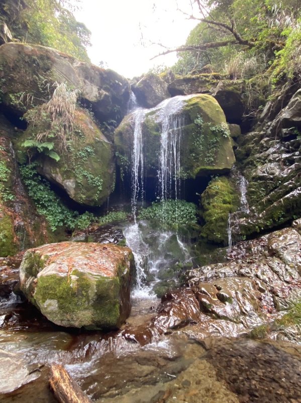
| 3 | 09:41 | 4.8 | H2376 | 絕美瀑布 | |
| 4 | 12:41 | 6.1 | ▲石水山▲(中午用餐休畢再出發) | ||
| 13:34 | 6.3 | ▲真鹿林山▲ | |||
| 6 | 14:19 | 7.3 | 鹿林山天文台 | ||
| 14:22 | 7.3 | H2862 | ▲鹿林前山▲ | ||
| 14:51 | 8.3 | H2881 | ▲鹿林山▲ | ||
| 15:41 | 10.3 | H2854 | ▲麟趾山▲ | ||
| 16:37 | 11.4 | 完登,玉山登山口 接駁車至塔塔加休息區 |
========== 總 計 ==========
●里 程:11.45公里
●時 間:7時12分47秒
●總爬升:1083公尺
●總下降:800.4公尺
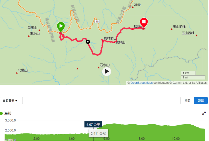
路徑規劃(GPX):
Blog:https://hiking.biji.co/index.php?q=member&member=1409581
========== 山 的 故 事 背 景 ==========
石山引水道(The Shishan Aqueduct )
石山引水道原是阿里山林場鐵路的石山線,拆除鐵軌後的路基成為供應阿里山水源的維護道路,全線腰繞石山而行,終點處即鹿林前山瀑布引水處,全程坡度和緩、處處可見水管橋和引水設施,是一條景觀多變、名副其實的水管路步道。
The Shishan Aqueduct was originally the Shishan Line of the Alishan Forestry Railway. After the removal of the railway tracks, the roadbed was transformed into a maintenance road supplying water to Alishan. The entire route encircles Shishan, with its endpoint at the Lu Lin Qian Shan Waterfall Intake. The trail features gentle slopes throughout, and is adorned with water pipe bridges and water diversion facilities, making it a truly scenic and dynamic water pipe trail.
塔加五連峰
塔塔加附近有五座2800公尺左右的中高級山,包括鹿林山/麟趾山/鹿林前山/真鹿林山/石水山等五座。全程約13公里左右,需時7-8小時左右。全程步道坡度起伏不大好走,真鹿林山與石水山步道路況稍差沿途有劍竹叢林戰,石水山的三角點不在地圖標示地,而是需往前下切後再前往約200-300公尺左右!至於鹿林山與麟趾山步道CP值超高,沿途景色秀麗展望極佳很適合大眾踏青路線! The Tatajia Five Peaks are a group of five intermediate to high-level mountains, each approximately 2,800 meters high, near Tatajia. The peaks include Lulin Mountain, Linzhi Mountain, Lulin Front Mountain, Zhenlulin Mountain, and Shuishui Mountain. The entire trail is approximately 13 kilometers long and takes about 7-8 hours to complete. The trail features relatively gentle slopes, making it suitable for hiking. However, the paths to Zhenlulin Mountain and Shuishui Mountain may be a bit challenging, with some sections covered by dense bamboo forests. Additionally, the triangulation point on Shuishui Mountain is not marked on the map but is located approximately 200-300 meters ahead after descending a bit. As for the trails to Lulin Mountain and Linzhi Mountain, they offer excellent panoramic views along the way, making them highly recommended for nature enthusiasts.
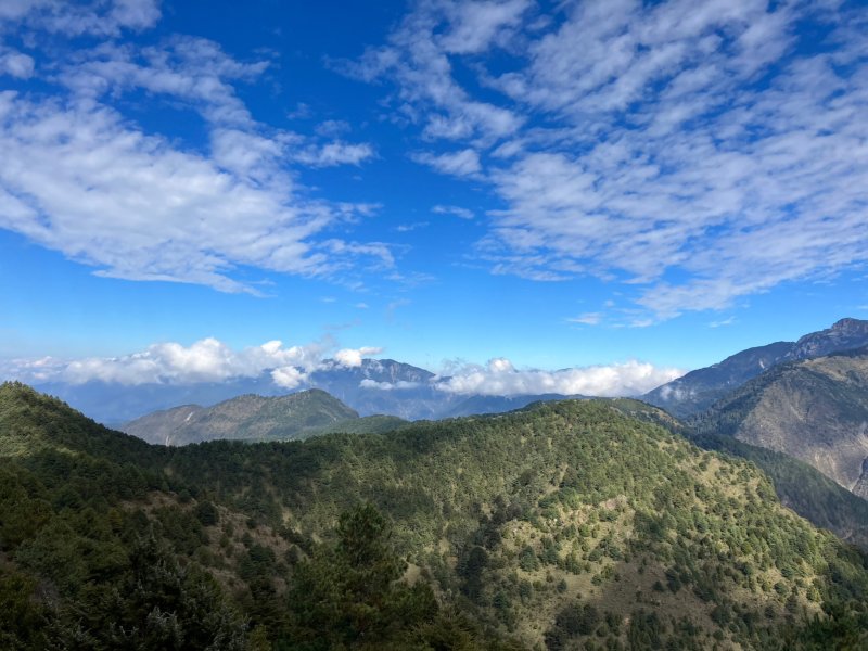
絕美瀑布
3-4登山過程
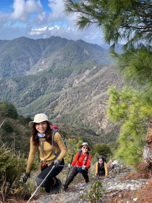
沿途美景: